By Franck Boynton, VP and CTO
Although we enjoy working with all of our customers, some projects just really are more fun than others. This was one of those projects.
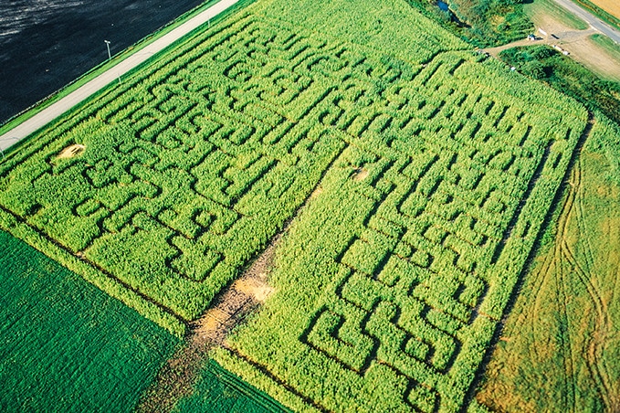
In March 2000, on the way back from a project where we were assisting with a military application, I got a call asking if I could help a farmer create a corn maze. He wanted something that could be done quickly with more precision than was available at the time. I told him I would get back to him the next day, but within 5 minutes I had the solution and called him back. We were able to reduce the number of hours to create the maze from 280 to 21, increasing the profit for the farmer and giving him time to tend to other tasks. This new method of using GIS and mapping was a breakthrough at the time, which also allowed farmers to easily create mazes of their own design. Over the years, many farmers took advantage of CMAP (our Corn Maze Assistance Program).

When I was in Tennessee working with an auto manufacturer, I was close enough to where the maze was that I made a surprise visit and walked it with the farmer. And yes, I did get lost. Photos of the maze circulated around on the Internet at the time as it was something quite novel. I wrote a paper on the process and won a “Best of” Paper award at the ION (Institute of Navigation) 2002 International Technical Meeting.
For more technical details about this project, click here.