Great Circle Path INS Simulation with Sensor Errors
The INS toolbox supports INS simulations of great circle paths including errors. As an example, consider the path from New York to Istanbul. The ideal path is plotted over a globe.
A demo program is provided with the toolbox to show how the toolbox functions may be used to simulate this scenario including sensor errors. The following sensor errors are simulated:
– 40 micro-g x-accel bias
– 50 micro-g y-accel bias
– 0.01 deg/hr x-gyro bias
– 0.015 deg/hr y-gyro bias
– 0.009 deg/root-hour x-gyro white noise standard deviation
– 0.005 deg/root-hour y-gyro white noise standard deviation
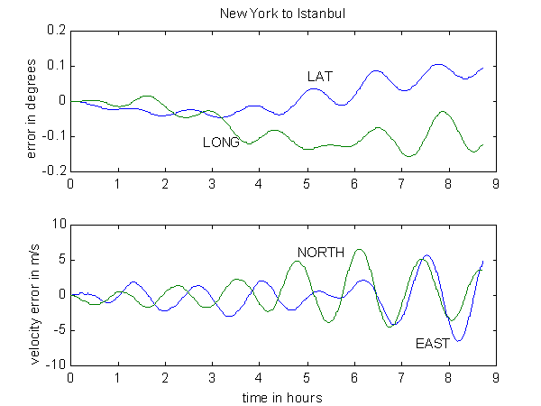
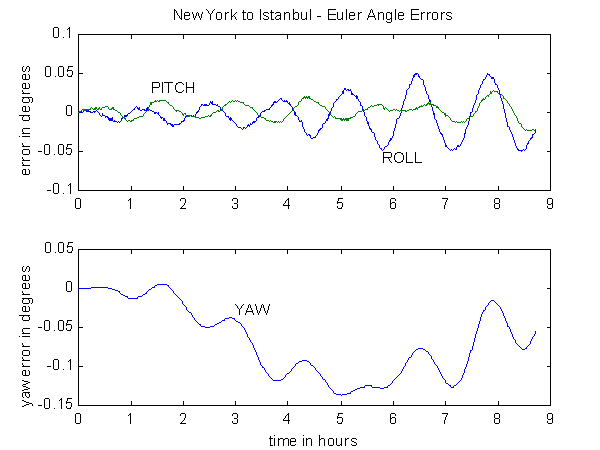
The position, velocity and attitude errors produced by the simulation are as follows:


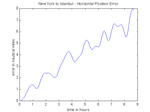
On such a global scale, however, it is easier to think of position error in terms of nautical miles rather than degrees of arc. The toolbox provides for this with some convenient conversion programs. At each point along the path, the (simulated) inertially-derived position (lat/long) can be converted into local-level-tangent coordinate system with the true vehicle position as the origin. In this way the two components of horizontal position error are calculated and may be root-sum-squared. The results shows a navigation-grade INS with the typical nautical-mile-per-hour accuracy:
